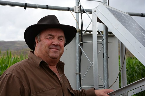
Utah dairyman Dee Waldron watches the weather closely. He wants clear, up-to-date weather and climate information anytime and anywhere that help him make critical farming decisions, such as when to irrigate, plant and harvest.
Waldron operates a dairy and feed grain farm in Morgan County, just east of Salt Lake City. This area is considered a high mountain desert and is not very productive without annual mountain streamflows stored in irrigation reservoirs.
“Before, I used to take a shovel in the field, dig down, and guess by feeling how much moisture was available for my crops,” Waldron said. “Now I use my computer and iPhone to access the local weather forecast, the amount of soil moisture, the snow levels in the mountains, the amount of water in the river, and even the soil temperature. This really helps us as agricultural producers.”
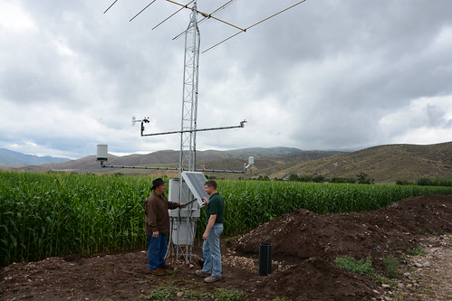
In recent years, the USDA has stepped up to make weather and climate data readily available to help reduce risks associated with production agriculture. As a long-time cooperator with USDA’s Natural Resources Conservation Service, (NRCS) Waldron was quick to agree to work with NRCS in establishing a Soil Climate Analysis Network, or SCAN site on his farm.
NRCS Soil Scientist Kent Sutcliffe, who manages the SCAN system in Utah, said the SCAN sites are located in valleys and capture real-time soil moisture and soil temperature measures that can help people better manage their farms and ranches. SCAN uses the same meteor burst communications technology as SNOwpackTELemetry, or SNOTEL, which NRCS uses for water supply forecasting based off remote station data gathered from snowpack on mountains.
Thanks to SCAN technology, Waldron and neighboring farmers now have quick access to hourly data transmissions on soil moisture and temperature collected between two and 40 inches deep in the ground, as well as air temperature, solar radiation, relative humidity, wind speed, wind direction and precipitation.
“The SCAN data has helped me determine the optimum time to water and as a result, last year I had the best corn crop I’ve ever had on this farm,” Waldron said. “I can sleep better at night knowing I can get up early, check the dew point on the computer, and decide if it’s the right time to bale my hay.”
In the last decade, the NRCS National Water and Climate Center and the National Soil Survey Center have worked with NRCS state offices to install more than 400 SCAN sites throughout the nation, with 38 being located in Utah. NRCS uses geographic information systems, or GIS, to identify potential SCAN sites. Ideal sites complement existing climate data, are located near irrigated agricultural areas and best represent an area’s typical soil profile.
SNOTEL and SCAN data are available at www.wcc.nrcs.usda.gov/scan/. The information does not predict drought, but it can be used to monitor drought development. It can also help monitor crop productivity relative to soil moisture, predict regional shifts in irrigation water requirements and assist ranchers and farmers in crop management decisions.