nrcs

Much Ado about Fisher

Located at the base of the Ashland Creek Watershed, the city of Ashland, Oregon, is home to nearly 21,000 people and a bustling tourist industry that revolves around world-class theatre experiences. Rogue Valley residents and tourists actively and passionately recreate in the Ashland municipal watershed, of which the upper portion is located primarily on the Rogue River-Siskiyou National Forest.

Like many areas in Southwest Oregon, a history of fire suppression has dramatically changed the way forests could potentially respond to fires. Stands once considered to be fire-adapted and fire-resilient have become densely overgrown. As a result of this fuels buildup, a high-intensity fire could result in the loss of the watershed’s largest trees, which help maintain soil stability and clean drinking water, and provide habitat for a diverse range of wildlife species.

Texas Water District, USDA Partner to Show Producers Way to Use Water Wisely

In the High Plains of Texas, water reigns. The area is one of the most productive agricultural regions in the world, making a reliable water supply key to the area’s rural economies.

The High Plains draws its water from the Ogallala Aquifer, an underground aquifer that spans eight states. Currently, the use of groundwater from the aquifer is unsustainable as withdrawals for cities, farms, ranches, industries and other uses exceed the natural recharge of the aquifer.

Bridging the Language Barrier for Asian Americans and Pacific Islanders

This post is part of the Science Tuesday feature series on the USDA blog. Check back each week as we showcase stories and news from USDA’s rich science and research portfolio.

The Asian-Americans and Pacific Islander (AAPI) population is projected to reach 35.6 million in the next 40 years, making it the fastest growing racial group in the country. One of those communities is that of the Hmong.

Over the past several decades, Hmong immigrants have adapted the traditional agricultural activities of their home environment to this country. Despite the contributions Hmong farmers make to the agriculture and food enterprise of our nation, they have faced a language barrier in the marketplace.

Regional Conservation Partnership Program - New Partners, New Resources, New Ideas

Last week, I visited with local communities in northern New Mexico. Many of these communities rely on irrigation ditches, called acequias, as their primary water source in an otherwise arid region. These are ditches that were used by their parents, and their grandparents, and their great-grand parents. Some acequias in the area date back more than 400 years.

Through the Regional Conservation Partnership Program (RCPP), NRCS is working with acequia communities and partners across the state of New Mexico to improve water quality, water quantity, and boost the overall health of these local irrigation ditches that so many rural American communities depend on. The Acequia San Rafael del Guique, for example, provides water for roughly 150 people in the Ohkay Owengeh and El Guique communities – it’s being revitalized as part of our RCPP project in the state.

A Hedge against Drought: Why Healthy Soil is 'Water in the Bank'

While most look to the sky for drought relief, an increasing number of farmers are looking to the soil. And for good reason: Healthy soils capture and store much more water – which can come in handy during dry spells.

Through its “Unlock the Secrets in the Soil” campaign, USDA’s Natural Resources Conservation Service is leading the effort to get more farmers and ranchers to adopt soil health management systems for a wide range of on- and off-farm benefits – including drought resiliency.

So what’s the water-banking secret in healthy soil?

USDA Pilots New Strategy to Recruit Minority Serving Institution Graduates

As we’ve celebrated Public Service Recognition Week this week, Secretary Vilsack and employees all across the government have shared what an honor it is to work as a public servant. But, it’s no secret that the federal hiring process is a lengthy one, which can be especially frustrating for recent graduates eager to begin careers upon earning their degrees. To streamline this process and meet an important hiring initiative—bringing qualified candidates with diverse backgrounds and more young people into our ranks—USDA has been piloting a new on-site hiring strategy at Minority Serving Institutions.

Working directly with the Office of Personnel Management (OPM), USDA has hosted five on-site events where USDA hiring managers collect applications, conduct interviews, and in some cases make job offers on the spot for internships and recent graduate positions. To date, USDA has collected 795 applications at these events, for a total of 276 available positions within 10 USDA agencies, including the Agricultural Marketing Service, Agricultural Research Service, Animal and Plant Health Inspection Service, Farm Service Agency, Forest Service, Grain Inspection Packers and Stockyards Administration, National Agricultural Statistics Service, Natural Resources Conservation Service, Risk Management Agency, and Rural Development.

Interactive Map Compares Past and Present Snowpack - Western Snowpack Levels Very Low

Western snowpack, where it remains, is in full melt.

All along the Cascades and Sierra Nevada are ski courses that never opened, bare mountains and snowless SNOTEL sites where snowpack is measured. Where snow accumulated, it melted prematurely during a warm March. One of the most common questions for snow surveyors has been: how does this winter compare to the past?

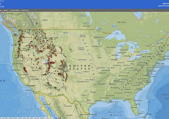
A new, interactive map shows you exactly how it compares. The online map, just released by the USDA’s Natural Resources Conservation Service, shows regularly updated current conditions - alongside historical records - for the entire NRCS snow survey network.

A Greenhouse Garden Inspires an Urban New Orleans School

Tucked in the middle of a mixed commercial and residential area of New Orleans still struggling to recover from the effects of Hurricane Katrina, is Carter G. Woodson Middle School − a state of the art public charter school known as Knowledge is Power Program (KIPP) Central City Academy.

As I wandered through the garden taking pictures and preparing for guests to arrive for the Greenhouse Garden Club ribbon cutting ceremony, I was intrigued by the markers made by students identifying the plants in the beds and statements about working hard and respecting the garden. 

“Hello miss! Our teacher sent us out here to keep you company,” said seventh-grader Keyira Powell.  She was accompanied by another student, Clifton Desilva who mostly stood in silence while Keyira − clearly a school ambassador – eagerly began telling me about the gardening club.

Measuring Environmental Effects of Conservation Practices

This post is part of the Science Tuesday feature series on the USDA blog. Check back each week as we showcase stories and news from USDA's rich science and research profile.

Have you ever heard the saying, “In God we trust, all others bring data?" Those are the words of William Edwards Deming, a distinguished American statistician and researcher. As an agricultural statistician at USDA’s National Agricultural Statistics Service (NASS), collecting and distributing reliable data are the most important things I do. The data we provide help shape many key decisions about all sorts of things related to agriculture, including conservation practices.

But I don’t only collect and distribute data. I get to administer the Conservation Effects Assessment Project (CEAP) survey – something I’m especially proud of. CEAP is a major project led by our sister agency the Natural Resources Conservation Service. The results of the survey contribute to a first-hand look into how operators maintain agricultural lands for tomorrow. This insight is so important because soil erosion, climate change, water shortages, and feeding ever-increasing populations are common concerns today.

With USDA Support, Aging Utah Dams to be Revitalized

In the 1950s and 60s USDA’s Natural Resource Conservation Service (NRCS), working with state, local governments and partners, designed and built many dams across the United States for flood and sediment control and water storage. Many of these dams are coming to the end of their design life.

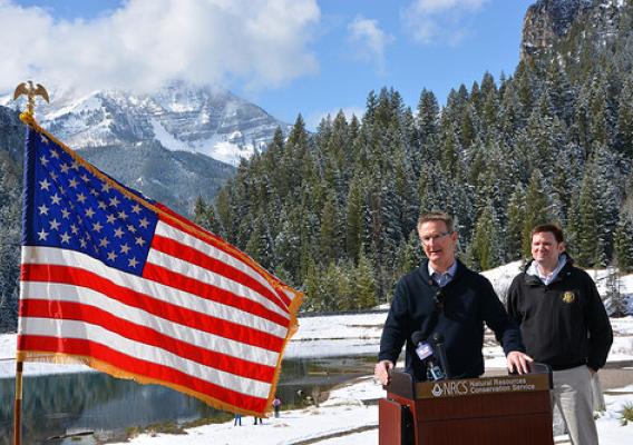
In early April, I traveled up the American Fork Canyon in Utah to Tibble Fork Dam to announce Utah would be receiving nearly $30 million dollars to rehabilitate aging dams.