
conservation

Wisconsin: Pollinator Week Highlights Buzzing Success of Local Beekeeper

Pam Gasper, of Chaseburg, Wisconsin, has been a bee keeper for the past three years. She recently restored 2 acres on her property to include natural habitat for bees through USDA’s Natural Resources Conservation Service (NRCS) Environmental Quality Incentives Program (EQIP). A dry summer and harsh winter in 2014 caused Pam to lose two of her three honey bee hives. She’s done her research, received technical and financial assistance from NRCS, and made some proactive changes for 2015. Pam is expecting a good harvest and “sweet reward” due to financial and technical assistance through EQIP from NRCS. She’s a strong advocate for the program and said the sign-up process was smooth and worth it.

NRCS staff provided financial assistance through EQIP and also the technical assistance Pam needed, including, site visits, a planting plan, providing options for obtaining seeds, and completing the final inspection of the successful planting just last week. Technical and financial assistance from agencies such as USDA−NRCS and programs like EQIP work to assist land users in accomplishing their goals.

National Network on Water Quality Trading Document Aims to Help New Program Development

USDA is committed to protecting streams, rivers and lakes through agricultural conservation, and has a long history of working with partners to implement the practices and policies needed to meet water quality goals. One of these policies, water quality trading, can help communities develop innovative, practical solutions for improving water quality, while generating environmental benefits at lower cost and increasing investment in rural America. At least twelve states have established one or more water quality trading programs—but creating the trading rules, working with stakeholders, and running a trading program can be difficult.

In 2013, The National Network on Water Quality Trading began as a dialogue between 18 organizations to tackle the challenges involved with establishing water quality markets. The Network represents a variety of perspectives, including farmers, utilities, environmental groups, regulatory agencies, and others interested in water quality trading. USDA participated in the process as a technical advisor.

Celebrating a World of Benefits from a Dwindling Resource

Tomorrow, USDA’s Natural Resources Conservation Service (NRCS) is joining the festivities at the sixth annual Pollinator Festival in honor of National Pollinator Week. Bees, butterflies, bats, birds, beetles and other animals play a critical role in the production of fruit or seeds, including plants that provide our nation’s food, fiber, fuel and medicine.

An estimated $15 billion worth of crops, including more than 90 fruits and vegetables are pollinated by honey bees alone. But despite their value, pollinator populations are dwindling due to threats of habitat loss, disease, parasites and environmental contaminants. That’s why farmers and ranchers are doing their part to improve the health of pollinators while providing benefits to the environment. Producers have worked with NRCS to voluntarily apply conservation practices on hundreds of thousands of acres of land because they know people and pollinators depend on each other for survival.

Protecting Pollinators through Habitat Conservation is Critical to Preserving Food Supply

“They’re in a happy mood today,” Jim Pratt, a local apiarist, said.

At a comfortable 62 degrees, honeybees buzz with a clear objective: collect nectar and pollen, for honey and pollination.

“Pollinators, like honeybees, support food crops,” Pratt said, explaining why for 20 years he’s raised honeybees.

Pratt’s Farm annually produces about 120 pounds of honey per colony. He maintains 100 colonies, collecting honey from them each spring, summer and fall. During the winter, the bees eat stored honey until warmer weather arrives.

Louisiana's "Teddy Bear" is Making a Comeback

On the brink of extinction in 1992, the Louisiana black bear was added to the threatened and endangered species list.

At the time of listing, more than 80 percent of suitable Louisiana black bear habitat was lost. The bottomland hardwood forests of the Louisiana Delta were cleared for row crop production; roads, homes and towns were built; and humans began encountering the shy, but curious, Louisiana black bear more often. The habitat fragmentation, or isolation of suitable patches of hardwood bottoms, affected the bears’ ability to travel for food, to find mates or simply to relocate to a more desirable spot to live. 

Rancher Weathers Drought, Restores Prairie Chicken Habitat at Same Time

By Sandra Murphy, Lesser Prairie-Chicken Initiative

USDA’s Natural Resources Conservation Service (NRCS) works with ranchers and partners to improve habitat for lesser prairie-chicken through the Lesser Prairie-Chicken Initiative (LPCI). Focusing on privately-owned lands, the initiative covers five western states. About 95 percent of lesser prairie-chicken habitat is located on private lands. Sandra Murphy is communications specialist for LPCI, a partnership led by NRCS. — Justin Fritscher, NRCS

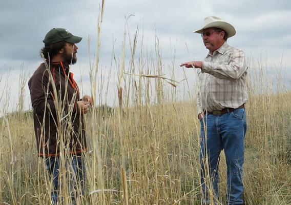
On a late April morning in southwest Kansas, sand bluestem sways over rancher Bill Barby’s head. A medley of other native grasses — little bluestem, sand lovegrass, and prairie sandreed, and more — fill the pasture around him, providing food for his cattle as well as habitat for the lesser prairie-chicken, a threatened species.

New Report Highlights Ranchers Restoring Habitat for Sage Grouse

Aldo Leopold once said, “Conservation will ultimately boil down to rewarding the private landowner who conserves the public interest.” Those words are powerful, especially in the West, where ranchers are partnering up to benefit sage grouse and the 350 other species that share its vast habitat.

Today, the Sand County Foundation, a non-profit organization named for Leopold’s signature book, “A Sand County Almanac,” released a report showcasing the dedication of private landowners in conserving this at-risk species that is currently being considered for listing under the Endangered Species Act.

Conservation Client Gateway: Conservation Just a Click Away

Ray McCormick is no stranger to conservation. Like his father and grandfather before him, Ray is a steward of the land and sets a high standard of conservation excellence. Last week I had the pleasure of meeting him and discussing his experience with our latest online tool – the Conservation Client Gateway.

During his 30 years of working with USDA’s Natural Resources Conservation Service (NRCS), Ray has made many trips to his local field office. However, now that he has a Conservation Client Gateway account, Ray can replace most of those trips with a few clicks of the mouse. He can log in to request conservation assistance, review and sign documents, track payments and much more - all at his convenience.

Keeping an Eye on the Nation's Chemical Climate to Protect Water Resources

Getting from Point A to Point B is sometimes a difficult task; that’s why we have maps.  However, making maps is not always easy, either, especially when the image you’re trying to capture is carried on the wind.

For nearly 40 years a coalition of government, education, industry, and other organizations has worked to monitor “precipitation chemistry” – in other words, tracking the makeup and whereabouts of acid rain.  Their latest efforts have resulted in maps that indicate how nitrogen deposition in the United States threatens aquatic life in the Gulf of Mexico.

All of Georgia's Soils Surveyed and Available Online-Contiguous States Mostly Complete

Soil scientists from across the southeastern region of the U.S. came together recently to celebrate the completion of Georgia’s soil survey. With this mapping complete, very few areas of the nation’s soils in the 48 contiguous states are not recorded.

USDA’s Natural Resources Conservation Service (NRCS) mapped soils information for Georgia’s 159 counties. The map data can be accessed online through NRCS’ Web Soil Survey.

Soil surveys involve studying the nature and properties of soils, mapping their location on the landscape and interpreting their unique sets of characteristics. The information found in these soil surveys was used by producers to better understand their soils, and how best to use and protect them.