Looks can be deceiving. Take the Houston Ship Channel located just east of the city of Houston. To the casual observer with a windshield view, they might briefly note the shipping vessels, grain elevators and day-to-day commerce as they speed by.
However, it’s on the Houston Ship Channel’s waters where, for some, the real action is taking place. This is where commerce meets conservation.
According to the Port of Houston Authority, an estimated 200 million tons of commodities and products annually pass through the 52-mile ship channel aboard more than 8,000 shipping vessels. To keep the channel deep enough for these large ships to navigate through, the channel has to be dredged on a continuous cycle.
Commerce, meet conservation. Through a multi-year Port of Houston expansion project which began in 1992, the U.S. Army Corps of Engineers Interagency Coordination Team created the Beneficial Uses Group, or BUG. Numerous BUG partners including the USDA Natural Resources Conservation Service, or NRCS, have utilized dredge materials to create manmade intertidal marshes, wetlands, oyster reefs, bird nesting islands and upland wildlife habitats.
“This is a very important project for the Port of Houston, over many years there has been a steady loss of wildlife habitat as marshes, islands, and wetlands have disappeared. We are actually taking what is a problem, the siltation of the ship channel, and turning it into a benefit for the environment, for animals, for recreation, for people who fish and catch crabs, and for commercial activity,” said Kirk Hanlin, assistant chief of the USDA Natural Resources Conservation Service. “Basically, what is happening is they are taking the dredge material from the Houston Ship Channel and making it into marshes and small islands so that there are both dry areas and wet areas which are beneficial for a lot of different species.”
To-date, more than 1,800 acres of intertidal marsh, 172 acres of oyster reefs, a six-acre colonial bird nesting island and more than 250 acres of upland wildlife and marine habitat have been created through environmentally and economically sound practices along the Ship Channel.
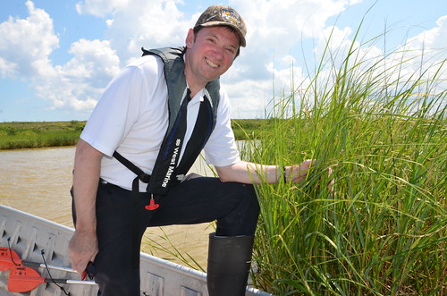
Hanlin recently traveled from Washington, D.C. to Texas to see NRCS’s conservation efforts within the state’s upper Gulf Coast region. During a boat tour of the Houston Ship Channel and Galveston Bay he saw first-hand the benefits reaped when partners pull together with a common goal.
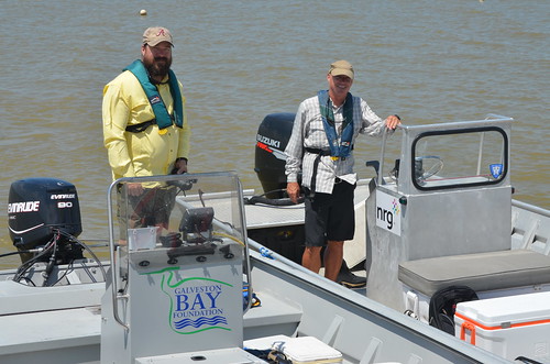
“One of the great things about this project is the partnerships that we’ve been able to work with. Groups like NRG, the Galveston Bay Foundation, Texas Parks and Wildlife, all coming together and working for a common goal and it’s really benefiting the people of Texas and the U.S.,” Hanlin said.

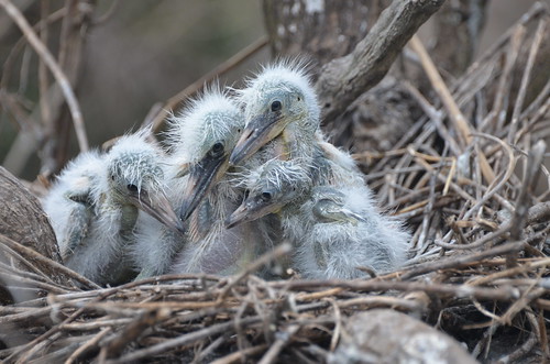
As Hanlin’s boat tour quietly drifted around the shore of the colonial bird island, they were greeted with a cacophony of bird species ranging from pelicans to herons to Roseate Spoonbills. Recently hatched chicks, along with juvenile pelicans, herons and Laughing Gulls were in abundance. In fact, two weeks prior to Hanlin’s visit, a bird survey done by NRCS Coastal Specialist Scott Alford, and Audubon Texas, estimated that more than 8,000 adult birds were nesting on the 11-acre island.
A tour of marsh sites like Atkinson Island Marsh and Burnett Bay Marsh along with upland habitats like Goat Island and St. Mary’s Island highlighted unspoiled wildlife and aquatic habitats created by dredged materials and hand-planted smooth cordgrass which was grown by NRCS and NRG staff at the nearby Baytown Ecocenter.
“This project is a perfect example of the importance of partnerships. This is something NRCS is really striving for, and the new Farm Bill encourages us to form more effective partnerships. When you look at it, the work that needs to be done here in this bay couldn’t be done by any one organization,” said Hanlin gazing across a marsh. “It really takes all of the organizations working together for a common goal.”
A model for Gulf of Mexico restoration is how Hanlin described the importance of the work being done in Texas.
“What we are doing here is actually an example that we think can be replicated across the Gulf. When you are looking at the Gulf of Mexico, we’re having a lot of erosion along the shore. We’re losing a lot of our small barrier islands and wetlands. Here we have a perfect example of how you can restore that very important ecosystem and also protect land inland, provide habitat for fish and wildlife,” said Hanlin.

