

Soil scientists don’t just map what’s under our feet but what’s below the water’s surface, too. Scientists with USDA’s Natural Resources Conservation Service (NRCS) are mapping and documenting the permanently submerged subaqueous soils of Barnegat Bay, a troubled estuary in New Jersey that is home to environmentally-sensitive habitats.
The bay’s ecosystem has degraded over the years from pollution, human development and other causes. NRCS soil scientists are now working an inventory of the bay’s soils that will identify the sources of the estuary’s decline and aid in its restoration.
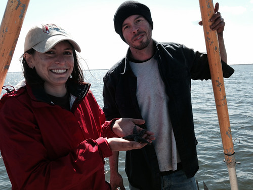
To make this happen, NRCS is collecting vibracores and field notes and describing soil samples as part of mapping the floor of the bay. Vibracores are samples of underwater soils collected in tubes.
In 2014, NRCS collected 54 vibracores, 34 were used to continue creating the bay’s subaqueous soil survey map. The other 20 helped the U.S. Geological Survey, through a dual agency agreement with NRCS, create a seafloor bathymetric map. Recovering and documenting a vibracore can take three to five hours.

Luckily, NRCS soil scientists had help. Fifteen NRCS Earth Team volunteers donated more than 500 hours to the cause. They include: Jennifer Nale, a University of Rhode Island graduate, who gave 122 hours; Kristy Northrup, State University of New York, who gave 180 hours; and Ryan Sullivan, a University of Rhode Island student, who gave 94 hours.
NRCS also had help from students and graduates from Virginia Tech, Marine Academy of Technology and Environmental Science and Villanova University.
“The volunteers assist with so many things on the boat,” said Rob Tunstead, leader of NRCS’ soil survey office in Hammonton, New Jersey. “They were amazing, and the soil survey project is that much closer to completion as a direct result of their assistance.
In an office with limited staff, the volunteers play important roles in the survey. The volunteers assisted with boating logistics and collecting data on soil color texture, fluidity, odor, horizon depths and hydrogen peroxide reaction.
The Earth Team volunteer program helps the agency meet conservation needs in communities. Volunteers enable NRCS to stretch available resources and help put additional conservation practices on the ground. Their efforts help improve land and wildlife habitat and contribute to cleaner water and air. Nationally, more than 25,000 volunteers donated 318,500 hours to the agency worth about $7.2 million.
This week, NRCS marks National Volunteer Week by recognizing the hard work of its thousands of volunteers, including the crew of 15 who helped NRCS soil scientists with their subaqueous soil survey mapping.
“We definitely will be using volunteers once again in 2015 and beyond,” Tunstead said.
This group was selected for the Earth Team Group Award. They are among four groups across the country to win this award. Other award-winning groups include volunteers who helped Canon City, Colorado, recover after a massive fire and volunteers who provide environmental education to youngsters in Missouri and Alabama. Read about other Earth Team volunteers.
Get involved with the Earth Team volunteer program.
