national forests

US Forest Service Waives Fees in Support of the Largest, Single-Day Volunteer Effort on Public Lands

As the waning, sweltering summer days transition to the cooler weather of autumn many people take the opportunity to give back by participating in the annual National Public Lands Day.

The Sept. 27 event, in its 21st year, is the nation’s largest, single-day volunteer effort in support of public lands. Last year, more than 175,000 volunteers at 2,237 sites worked hard, collected an estimated 23,000 pounds of invasive plants, planted about 100,000 trees, shrubs and other native plans and removed an estimated 500 tons of trash.

US Forest Service Chief Highlights Importance of Agency's Role in Evaluating Groundwater Resources

In recent years, we’ve seen growing concerns about the availability and quality of water across the country. Drought, climate change, land use changes, and needs for additional water highlight these concerns. Stewardship of water resources is one of this country’s most important natural resource issues. In fact, it’s one of the primary reasons national forests and grasslands were created.

As part of our renewed emphasis on water, we are developing a comprehensive policy to monitor, assess, evaluate and measure groundwater resources on national forests and grasslands. We began seeking public comments on May 6 asking your thoughts on a plan to strengthen our ability to protect water resources and support healthy and resilient ecosystems on Forest Service-managed lands. We extended the comment period to Oct. 3.

Land Acquisition Protects Headwaters in Oregon's Malheur National Forest

On July 10, the Rocky Mountain Elk Foundation and Malheur National Forest celebrated one of the largest land acquisitions in the history of the Pacific Northwest Region of the Forest Service.

This acquisition of 13,085 acres will consolidate protection of the headwaters of the John Day River, which drain from the Strawberry Mountains. The new land will fill in the gaps of what was a checkerboard arrangement around the headwaters, creating a protected area which now stretches more than 20,000 acres. Along with hunters and other recreationists, several species of wildlife and fish will benefit from this crucial linkage with existing public lands and established wildlife corridors. The river itself is home to endangered bull trout, as well as redband rainbow trout. It is also the destination for spawning mid-Columbia steelhead and chinook. Elk, deer, black bear, pronghorn, mountain goats, grouse and quail also make their home on the land surrounding the headwaters.

Veterans 'Walk Off the War' along the Pacific Crest Trail

U.S. Army veterans Shawn White and Tom Bielecki, along with U.S. Marine Corps veteran Kevin Black, set off to hike the entire Pacific Crest National Scenic Trail on April 12 as part of the Warrior Hike’s Walk Off the War program.

Along the 2,650-mile journey, they will hike through 25 national forests.

They recently passed through Plumas National Forest and stopped in Plumas County, California, where they were welcomed by the local community and invited to participate in the Mohawk Valley Independence Day festivities. The warrior hikers attended all of the weekend’s festivities, including a special recognition ceremony honoring all veterans that followed the Independence Day parade, appropriately themed “Honoring Our Veterans.”

Land Conservation Strengthens Rural Communities: Examples of the Land and Water Conservation Fund at Work

The Forest Service’s Land and Water Conservation Fund investment in national forests and grasslands has ripple effects that extend far beyond the Forest Service and the land that is protected.

The Land and Water Conservation Fund, created by Congress in 1964, provides resources to federal, state and local governments for the conservation of important lands, waters and historical sites.  Using no taxpayer dollars the Fund uses earnings from offshore oil and gas leasing to help preserve our history, protect our lands and strengthen our economy. Nationwide, over 7 million acres have been protected.

Rocky Mountain Wetland Provides Fen-tastic Habitat for High Altitude Plants, Wildlife

Sloshing through a wet meadow in ankle deep water, I am surrounded by thick mats of sedges, rushes and some beautiful wildflowers. This saturated meadow lies in the shadows of the 13,000-foot Sheep Mountain peak near Trout Lake, Colorado. It is a scenic spot, rich in plant diversity, but also a unique habitat in Colorado.

I am visiting this lush, high-altitude wetland with the Grand Mesa Uncompahgre and Gunnison National Forests’ lead hydrologist, Gary Shellhorn who explains that this wet meadow is called a fen. Fens are peat-forming wetlands, created when wetland plants die leaving mats of dead and decaying plant matter. Fens are sustained by mineral-enriched groundwater, which is less acidic.  For this reason fens support a more diverse plant and animal community. In southern Colorado, it takes about 2,000 years to accumulate eight inches of peat at a fen. This suggests that most fens are 4,000 to 10,000 years old.

Charles E. Bessey Nursery Showcases its 'Babies' - Seedlings That Will Become 'Forests of the Future'

Two million seedlings will grow up one day to become the forests of our future.

The vision for all of those trees is part of the mission of the Charles E. Bessey Nursery, part of the Nebraska National Forests and Grasslands, and the oldest federal seedling nursery in the nation.

Working with the Bessey Ranger District and the volunteer group Friends of the Nebraska National Forests, the nursery recently invited the public in for a rare opportunity to see the nursery in full production; growing, packing and shipping hundreds of thousands of seedlings to U.S. Forest Service, Bureau of Land Management, conservation districts and other government agency locations. The seedlings are used for reforestation following fire and insect infestations, wildlife/habitat plantings, wind breaks, conservation plantings, and general planting.

New Web-Based Tool Helps Land Managers Plan for Forests' Future

This post is part of the Science Tuesday feature series on the USDA blog. Check back each week as we showcase stories and news from the USDA’s rich science and research portfolio.

From South Carolina’s coastal plain to the North Carolina mountains to the tropics of Puerto Rico to the southern Sierra Nevada region of California, climate change is on the minds of forest planners.

That’s because U.S. Forest Service planning teams in these areas are among the first to revise their land and resource management plans under the 2012 Planning Rule. To help them in their planning, land managers from the Francis Marion, Nantahala, Pisgah, El Yunque, Inyo, Sequoia, and Sierra national forests will turn to a web-based tool known as the Template for Assessing Climate Change Impacts and Management Options.

Forest Plans help guide the management of national forests and are typically revised every 10 to 15 years. The plans help ensure that national forests and grasslands continue to meet the requirements of the National Forest Management Act—for clean air and water, timber and other forest products, wildlife habitat, recreation and more.

Let's Move Outside All Summer Long

Summer is fast approaching but packing up the kids to head outside could be daunting, especially for those whose experience with outdoor activities is limited.

But don’t worry. With a little help and some simple planning, the whole crew will want to unplug and find activities that will invigorate not just the body, but the mind. The opportunities to show our kids how to eat healthy and be active can stay with them for a life time. Young children and the young at heart will enjoy summer days filled with picnics and outdoor barbecues that create great memories.

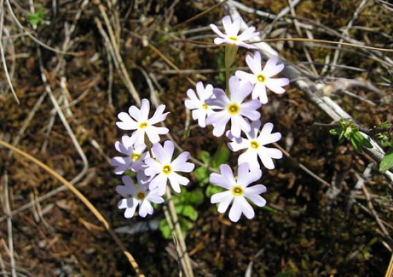
It's National Wildflower Week! Get a Little Wild with Flowers on National Forests and Grasslands

Walking along the peaceful Hunter Creek Road in the Charles C. Deam Wilderness, in the Hoosier National Forest, you catch a glimpse of beautiful periwinkle flowers swaying in the warm spring air. A short hike uphill and you are immersed in the full bloom of wild hyacinth, along with other delightful wildflowers such as twinleaf and trout lily.

While getting caught up in the beauty and serenity of this colorful scene, you may observe a white-tailed deer, raccoon, fox squirrel, red-shouldered hawk or scarlet tanager. This enchanted corner of the Hoosier National Forest is its only congressionally designated wilderness. It boasts plentiful spring flora thanks to its proximity to a geologic feature known as the Mount Carmel Fault. And, this is just one of 82 Wildflower Viewing Areas in the Forest Service’s Eastern Region