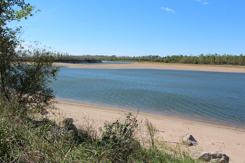
In southern Illinois, along the Mississippi River, you can see a diverse landscape of woodlands, open wild areas and farmland. But that wasn’t the case about 20 years ago, after the Great Flood of 1993 ravaged the area. That summer, all of these ecosystems resembled a moonscape with most of the vegetation removed.
In the wake of the flood, USDA’s Natural Resources Conservation Service (NRCS) offered easement purchases through its Emergency Wetlands Reserve Program to help landowners take frequently flooding cropland out of production and restore functional wetlands.
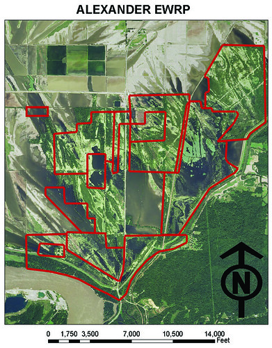
In Alexander County alone, landowners enrolled seven easements covering 3,089 acres. This compilation of easements forms a “contiguous piece of Mississippi River floodplain,” says Dave Hiatt, NRCS biologist, providing prime habitat for local wildlife as well as migrating wildlife.
“Each easement connects a larger area that gives migrating birds a place to rest and feed before traveling on,” he says. “Located at the top of the Mississippi Alluvial Valley, this locale is now a major migration staging area.”

Wetlands also help reduce damage from floods, contribute to groundwater recharge and carbon sequestration and provide recreational opportunities. They are among the most biologically diverse ecosystems in the world. Even during significant droughts like the one experienced in Illinois and other parts of the country this past year, wetland areas support wildlife and plant species.
Once a landowner places his or her land in a conservation easement with NRCS, he or she retains the title to the land and the right to control access and recreational use, and still pays taxes on the property.
Alternatively, the landowner can sell the property. In this case, the U.S. Forest Service purchased 3,000 acres of land encumbered by easements from landowners in order to restore the wetlands, which are adjacent to the Shawnee National Forest.
Other easements purchased in Alexander County over the past 20 years have added another 2,367 acres of wetlands to the Wetlands Reserve Program; nearby Union and Jackson counties have several easements totaling thousands of acres in NRCS programs.
NRCS biologist Hiatt calls these wetlands a beautiful “string of pearls along the Mississippi.” These “pearls” help clean the water and support native flora and fauna that we can all enjoy for years.
Follow NRCS on Twitter.
Check out other conservation-related stories on the USDA blog.


