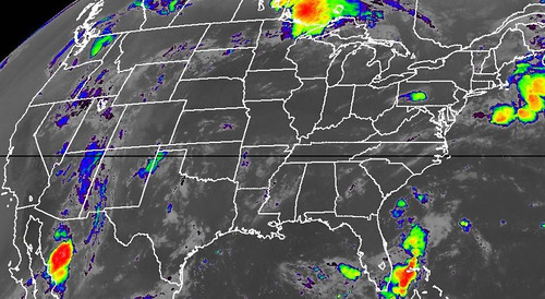
Weekend thundershowers provided limited and localized relief to a few Midwestern fields, but most of the Corn Belt remains in dire need of moisture. Currently, very hot weather is building back into the Midwest. High temperatures above 100°F can be expected in portions of the western Corn Belt for the remainder of the week. The eastern Corn Belt should experience some mid- to late-week heat relief, but only scattered showers will accompany the transition to cooler weather. Like last week, substantial drought relief will be confined to the Southeast.
Midwestern crop conditions continue to decline under a hot, mostly dry weather regime. Thirty percent of the U.S. corn crop was rated in very poor to poor condition on July 8, 2012, according to USDA/NASS. Not since 1988, when half of the U.S. corn crop was rated very poor to poor, have corn conditions been lower in July. The last time at least 30 percent of the U.S. corn was rated very poor to poor was September 2002.
The outlook for next week (July 22-28) calls for a hotter- and drier-than-normal weather pattern to persist nearly nationwide.