Visit www.usda.gov/drought for the latest information regarding USDA’s Drought Disaster response and assistance.
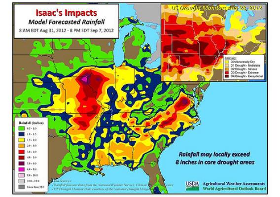
Hurricane Isaac moved ashore early Wednesday, August 29, in southeastern Louisiana with maximum sustained winds near 80 mph. Once inland, the storm steadily weakened, losing its tropical characteristics over Missouri on Saturday, September 1. Nevertheless, Isaac’s remnant circulation continued to drift across the eastern Corn Belt during the Labor Day weekend, generating locally heavy showers from the lower Midwest into the mid-Atlantic region. Storm-total rainfall reached 10 to 20 inches in the central Gulf Coast region, while some drought-affected areas in Arkansas, Missouri, and Illinois received in excess of 4 inches. In the Mid-South and lower Midwest, positive effects of Isaac’s rainfall included replenishment of soil moisture in preparation for the soft red winter wheat planting season and starting the process of pasture recovery.