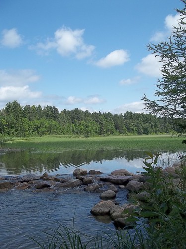
The headwaters of the mighty Mississippi River flow through Camp Ripley, a military facility that serves as the National Guard training center for Minnesota and six surrounding states. Straddling 50 miles of the Mississippi River, the area also includes the watersheds of four major tributary rivers, making it one of Minnesota’s most important sources of drinking water. Its 45,000 acres of open water support many fish, animal, and bird species, as well as recreational opportunities for residents, tourists, and outdoor enthusiasts.
When first established, Camp Ripley sat in the middle of farms and forests, surrounded by plenty of open space to conduct training exercises without worrying about the effects of noise, dust, and smoke. But times have changed. More than a quarter of the area’s upland forests has been lost since the late 1800s. Ensuring the quality of water for downstream cities, as well as the national security mission of the training facility, meant coordinating forest management plans across multiple ownerships.

About a third of the surrounding land, some 216,000 acres, is in small private holdings of 60 to 100 acres. Most property owners manage their land for wildlife or hunting; some receive income from the sale of firewood or aspen pulp for paper.
The USDA Forest Service partnered with Camp Ripley, the Minnesota Department of Natural Resources, Minnesota Forest Resources Council, Minnesota Board of Water and Soil Resources, Forest Service Northeastern Area, several county soil and water districts, and The Nature Conservancy to develop solutions that would work for all landowners. As a result, the landscape is now part of the Sentinel Landscapes Partnership, dedicated to promoting natural resource sustainability in areas surrounding military installations.
As part of this coordinated effort, the USDA Forest Service Forest Stewardship Program (FSP) helped hundreds of private landowners to develop forest management plans. Key strategies focused on keeping working forests as forests and encouraging owners to protect water by adopting best management practices, especially near water sources.
“Some 260 private landowners in the area now have forest stewardship plans,” said Dennis McDougall, Forest Service Stewardship Program regional coordinator. “These plans are tailored to the needs of the individual landowner, whether it’s improving tree health or wildlife habitat or generating income.”
FSP also provides landowners with enhanced access to other USDA conservation programs, certification programs, and forest product and ecosystem services markets. These planning and partnership efforts have attracted additional funding, including a recent grant from the USDA Natural Resources Conservation Service for $2.8 million.