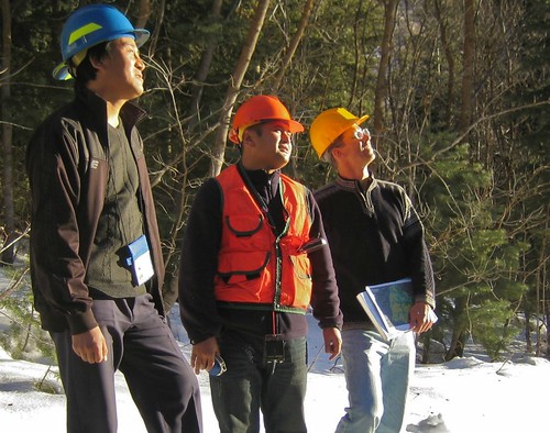
Bhutan is a small mountainous kingdom nestled in the Himalayas. Some people know it as the country that measures gross national happiness in addition to its gross domestic product. Others may have heard about its innovative, eco-friendly approach to tourism or of its Dragon King’s royal wedding in 2011.
The staff of the U.S. Forest Service, on the other hand, is getting to know Bhutan and the Bhutanese people for a different reason: training and collaboration in remote sensing for improved management of forests and wildlife.
Hosting and working with their Bhutanese colleagues, Forest Service employees are helping them develop geographic information system data from remote sensing imagery related to historical wildfires and current tree canopy cover in Bhutan.
During the last few years, the Forest Service has partnered with Bhutan with support from the U.S. Department of State and the U.S. Agency for International Development. Past projects have focused on the Eastern Himalayas, whose mountain range shares similarities to the U.S. Rockies.
Since mid-February, Bhutanese foresters Kinley Tshering and Phub Dhendup, both from the Bhutan’s Ministry of Agriculture and Forests, Department of Parks and Forests, are spending most of their time at the Forest Service’s Remote Sensing Applications Center in Salt Lake City. Near the end of their training, they will spend a week in Missoula, Mont. visiting the Forest Service’s Missoula Fire Sciences Laboratory, Northern Regional Office and the University of Montana, Department of Forest Management.
The Forest Service’s partnership with Bhutan dates back more than a decade including assisting Bhutan’s National Forest Inventory efforts and leading fire management training sessions tailored for the country. More recently, the Forest Service has been sharing decision support tools, such as forest fire history mapping, with South Asian countries like Bhutan.
The burn history layer is an important tool for Bhutan, whose economy is largely based on forestry and agriculture. In a pilot project, the Forest Service generated burn severity data for Bhutan during 1999-2001 for wildfires larger than 200 hectares.
One of the Forest Service’s objectives of the Bhutaneses’ visit to the United States is to teach them fire mapping process and increase the number of years for which the burn severity data are available. Additionally, the Bhutanese are learning how to use satellite imagery with photo interpreted and field inventory data to map tree canopy cover over the entire country. Combined with new inventory data, the fire history and canopy cover layers will give Bhutan one of the best estimates of forest carbon pools in Asia.
When the Bhutanese foresters return home, a Forest Service employee will travel to Bhutan to help inform other Bhutanese colleagues about their newly developed skills.
The Forest Service has also been working with neighboring countries in South Asia during the last three years. They include Nepal and India as part of the State Department-funded regional Eastern Himalayas Initiative, and bilateral collaboration with forestry departments and colleagues in Bangladesh and India.
