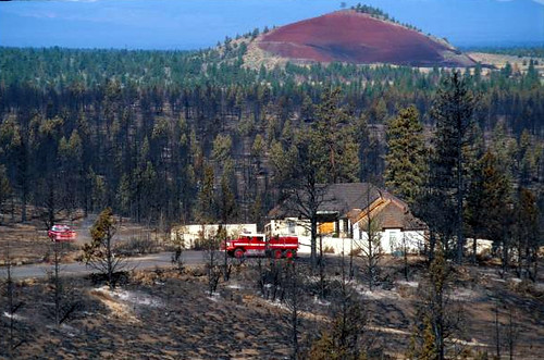
If I were to go running on my favorite trail on the west side of town and ask one of the homeowners, whose house abuts the natural area, to describe where they live, I am guessing they would first say Fort Collins, or maybe offer the name of their neighborhood, followed by “at the base of the foothills.” I am almost certain they would not tell me that they live in the “wildland urban interface.” Yet, that is exactly where they live.
There is a growing population that seeks refuge in and near forests and other natural areas. Not for hiking, biking, and picnicking, but rather to live, in primary residences and second homes. The beauty of the landscape is a great impetus for deciding where to locate. This inspiring beauty, however, masks a wide range of potential threats, of which many homeowners are unaware.
One of the biggest potential threats inherent to living in or near a forest is wildland fire. Not only are homes at risk, but the lives of homeowners and firefighters are at risk. For taxpayers, suppressing fire to save homes in the wildland urban interface is a costly endeavor. A recent report showed that more than 50 percent of the Forest Service budget is spent fighting wildfires, and that is in addition to local, state and other federal spending on wildfires.
Wildland fire is not the only threat. Increased risk of invasive species and disruption of wildlife and ecosystem processes often accompany human habitation.
In all regions of the country, the wildland urban interface is growing, and with it, not only concerns about wildfire, but also the other potential ecological harm that occurs when people build a house in the woods.
If you want to see where the wildland urban interface is, you need to look no further than the beautifully designed atlas that was just released, The 2010 Wildland-Urban Interface of the Conterminous United States. This full color atlas, with high-resolution maps for 48 U.S. states, shows housing density, land cover, vegetation, and wildfire history. All of the data behind the maps are available for public use – making this an excellent tool for land managers, city planners, state and local officials.
Maps provide an interesting perspective on the nation’s wildland urban interface. You might think most of it is in the western half of the nation, but the states with the most wildland urban interface area are actually in the northeast, with Connecticut, Massachusetts, and Rhode Island topping the list.
People’s desire to live in, or on the fringes of natural areas is not likely to change. What we can change is access to information that gives homeowners a more complete picture of what it means to build homes in and near beautiful landscapes.


